Hakuba Yarigatake
Hakuba Yarigatake. Not to be confused with “just” Yarigatake, another mountain in the same range. I’ll refer to Hakuba Yarigatake as ‘Yari’ throughout the report.

I’m fiending for an alpine start - me to my touring partner Josh in Feb of 2026.
You might be wondering “what is an alpine start”? Per the Goog, “a mountaineering technique of beginning a hike or climb very early—typically between midnight and 4:00 AM—to beat the sunrise. This strategy allows climbers to traverse snow/glaciers while they are firm and frozen, reduces risks of rockfall, avalanches, and afternoon thunderstorms, and maximizes daylight hours”. If you’re a SLC-based skier, you might also find yourself alpine starting because you have to make it back in time for your job. And if you’re wondering what a “job” is, it’s something people do to make money so that they can afford to go skiing 🙂.
In the northern Japanese Alps, the lift-access backcountry can spoil you. Instead of human-powered backcountry-skiing (i.e. earning your turns by hiking up), I slammed Snickers and onigiri on the lift up and rode untracked japow down. Rinse, repeat. Were the turns less-earned? Probably. Was my fitness worse compared to the winter before? Arguably. But was I living my best life? Undoubtedly.
While safety is the main utility of an alpine start, a less obvious trade-off is that the sun is always out by first chair (winter sunrises in the Japalps never breach past 7 and lifts start spinning around 8)…meaning you’d never catch a proper sunrise if you relied on lift-access! All those Snickers and onigiri satiated my hunger, but my soul still craved the magical transitions from night to day that I had been blessed to experience dawn patrolling the Wasatch…
A couple weeks later, Josh and I began to observe a weather window in the forecast. After Shirouma-dake (mission report) inspired confidence in our teamship, our eyes were now set on a prominent couloir off Yari’s eastern aspect.
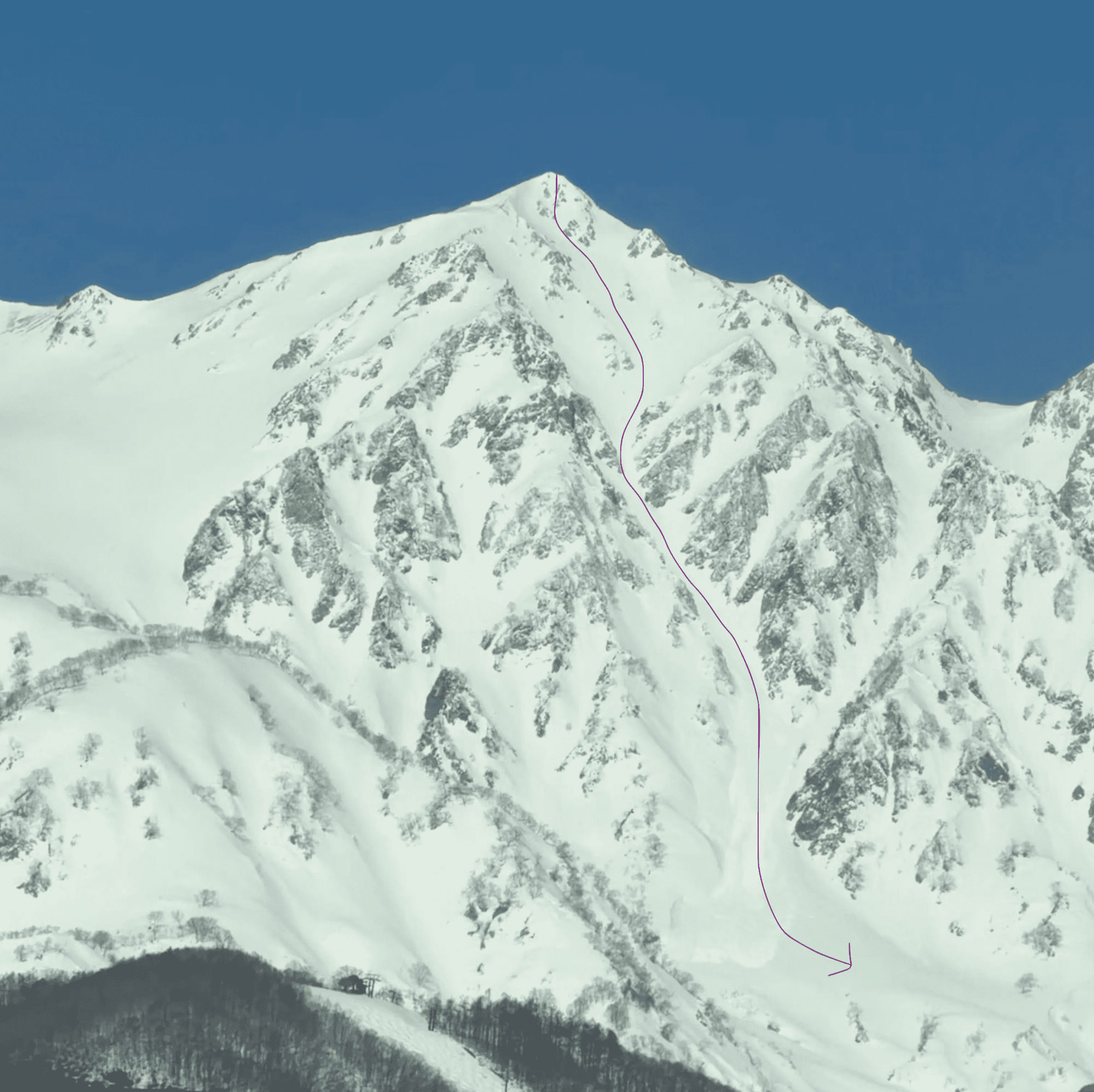
Yari, though 30m shy of Shirouma, is a much longer endeavor than Shirouma. Here’s the breakdown in numbers:
Shirouma (February 17th) | Yari (March 14th) | |
Start elevation | 1582m (EVE Gondola dropoff) | 898m |
Summit elevation | 2932m | 2903m |
Total elevation gain | 1887m / ~6200ft | 3286m / ~10000 ft |
Distance (RT) | 23km (11km out, 12km back) | 26km (15km out, 11km back) |
Time Elapsed (car-to-car) | 8h35m | 14h51m |
Preparation:
I looped in my friend Rick as our 3rd and together we formulated an approach plan. There were 3 options in consideration. Obinata South (skidescent), Obinata North, and Daisekkei (unofficial networks). Thank you Joel O’Rourke and Zach Paley for the write-ups! Fun fact: I had actually run into Zach multiple times in Japan. We exchanged numbers and I got to pick his brain (he opted for Daisekkei and encouraged us to do so as well). While shorter, Obinata South ascends a waterfall that had questionable snow coverage whether that be from new snow or avalanche activity. Daisekkei promised a shorter route but required us to traverse across a spicier ridgeline that none of us had much experience on. Thus, we approached using the “Obinata North” route, which follows the trail from the Sarukuraso Lodge that breaks southwest to the col west of Mt. Obinata.
The avy forecast didn’t warn of wet slides, but we still wanted to minimize our time on south aspects in above-freezing temps. That, combined with a forecasted cloud layer around 2pm had us setting a target drop-in time of noon-ish. Though the avalanche report had recently been reporting a wind slab problem on our line’s aspect and elevation, we felt comfortable. Rick had been skiing the same aspect and elevation nearby just the day before looking for reactivity and found nothing.
Summit Day
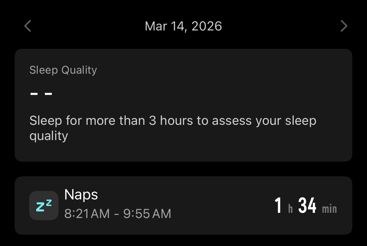
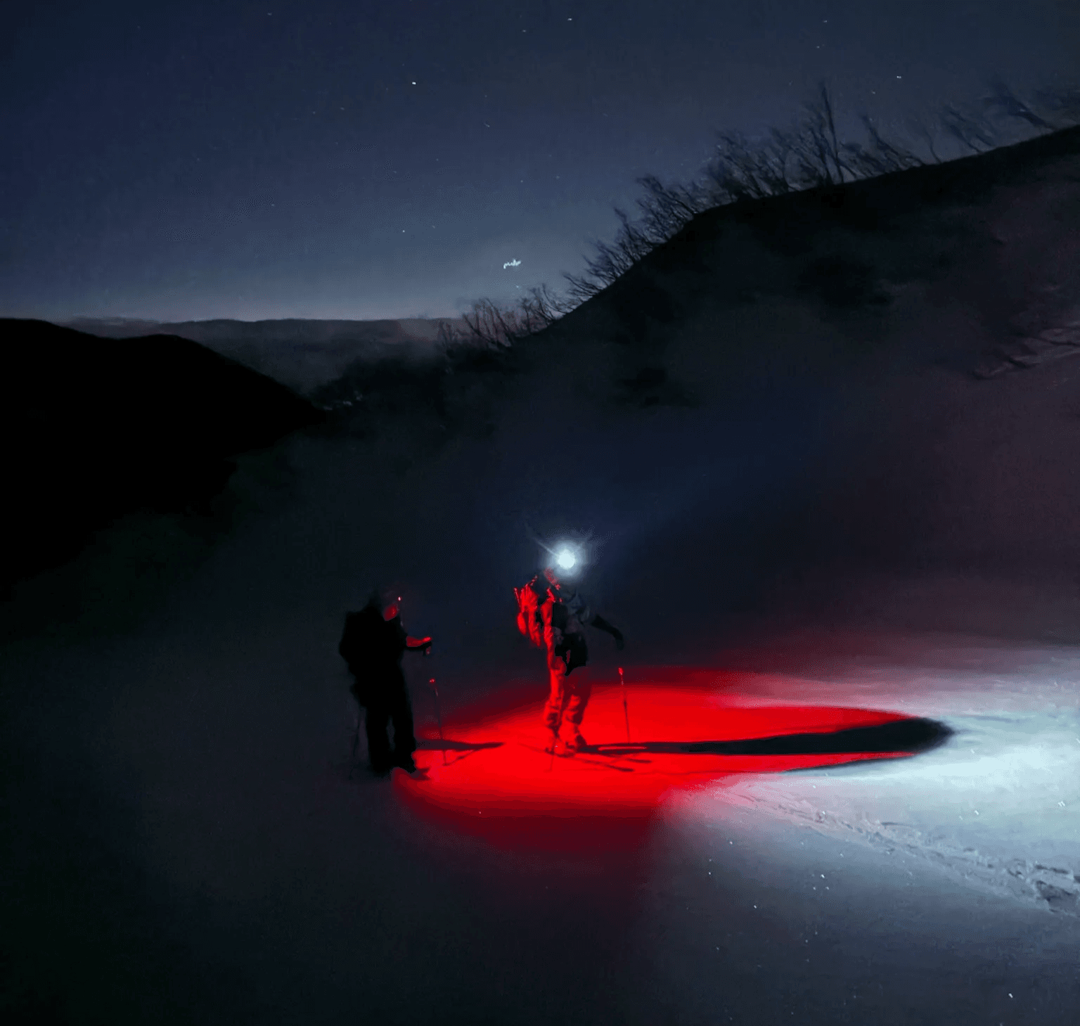
Due to extenuating circumstances, I slept just before midnight. Alarm woke me at 12:55am. Fffffffff-. I was already in for a long day but doing it on an hour of sleep meant I was going to be in the trenches. I schlepped my gear and myself into Rick’s purring van outside. 5 minutes into our drive, Rick admits that his plan was to drop me off at the trailhead and bail home as he only got 1 hour of sleep. I think I laughed out loud. “Rick, I’m running on 1 hour too”. At the trailhead, when Josh also mentioned he three was running on 1 hour of sleep, Rick capitulated while mentioning once or twice he was probably going to turn around. He never did! The only sleep my watch registered was when Josh and I found a flat area to nap while Rick caught up (see below).
The first several hours of uphill were less of a slog than I anticipated with adrenaline galvanizing us into a rhythmic march. Not quite a sensory deprivation chamber with stars, headlamps, and the zip-zip of mohair skins but enough serenity to tap into a different wavelength. Just as I got out of my head and into my body, I observed myself sink into a calm headspace and let my body autopilot breath and movement into an exothermic shuffle that offset the cold bite of the air.
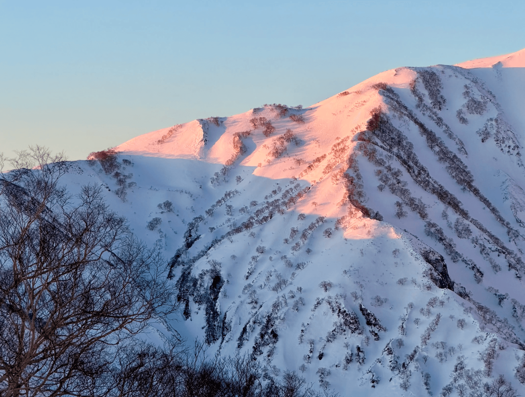
Sunrise
I appreciated the fortress we hiked ourselves into as it illuminated via morning twilight. My wish to alpine start had been fulfilled in spades, manifesting into a dawn patrol of all time.
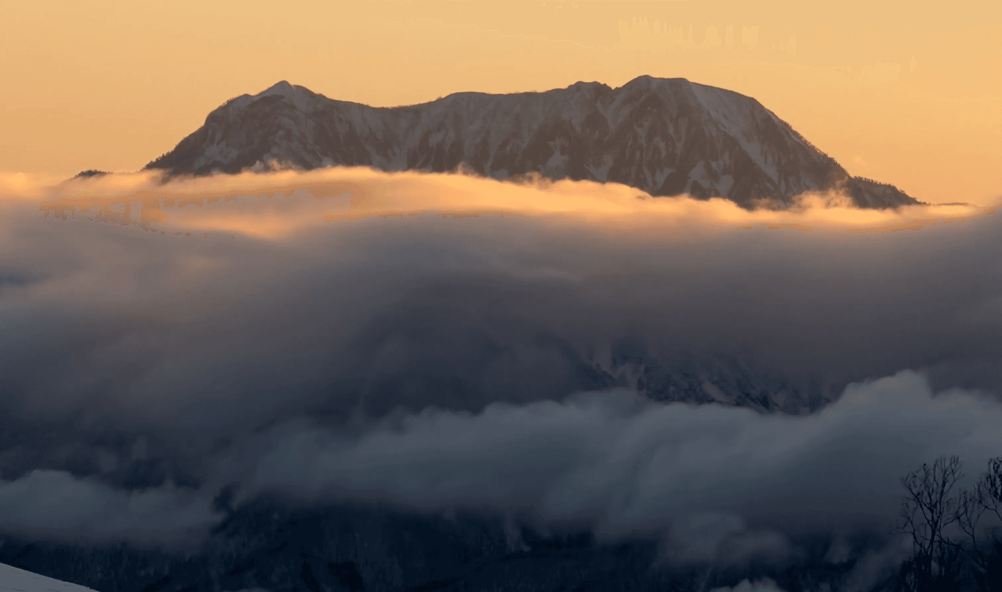
Rosy alpenglow flooded our detoxed senses, melted away any residual fatigue, and blew the neurotransmitter faucet wide open - I was GIDDY with glee!
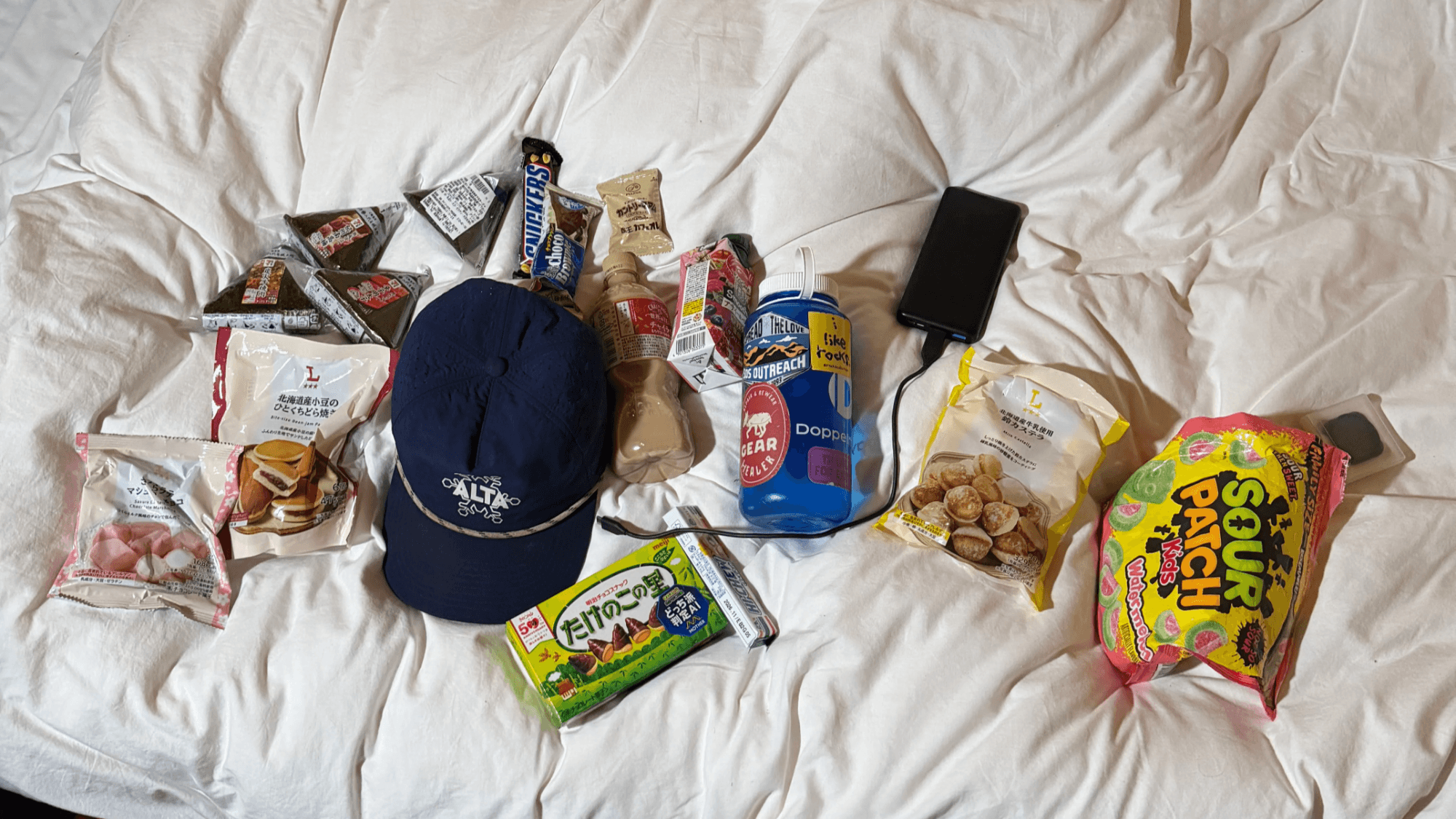
Our momentum compounded and we inched on. We zipped and kicked past clouds of sulfur emanating from the Yari onsen fumarole. Intermittent breaks to shed layers and feast on carbs were taken (see the Yari nutrition plan below). Shoutout the homie Jie-En for the Sour Patch 💛.
Summit Push
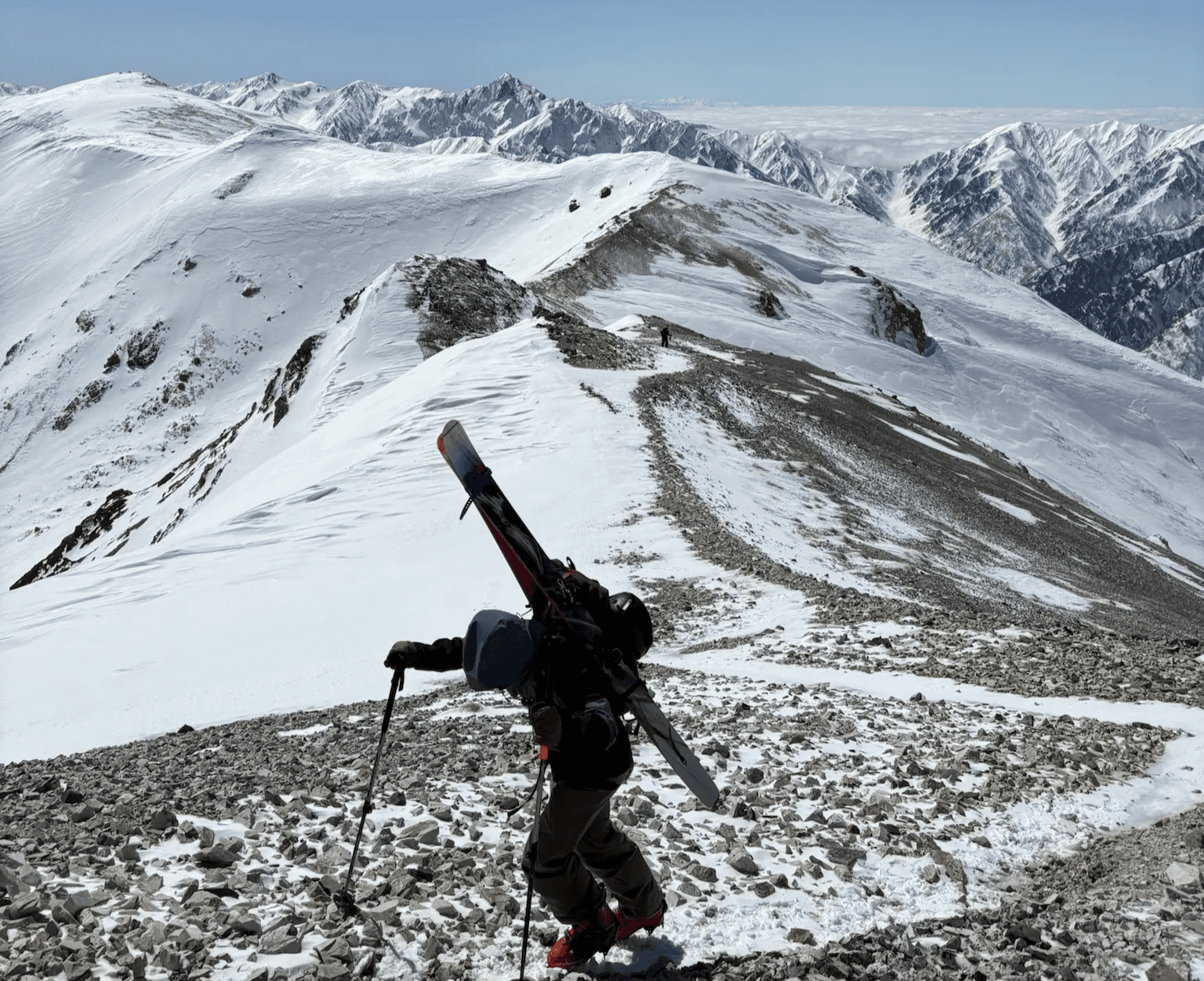
Getting onto the final ridge was the most technical section, with all of us deploying sharps for aid. After traversing the bald ridge up to the peak, we took pause to check-in amongst ourselves and recollect for drop-in.
The low-hanging clouds sneaked in around 1pm, an hour earlier than forecasted. Shit. I watched Rick and Josh drop in first with some urgency. Then it was my turn! Up top, the couloir skied as well as we could have hoped.
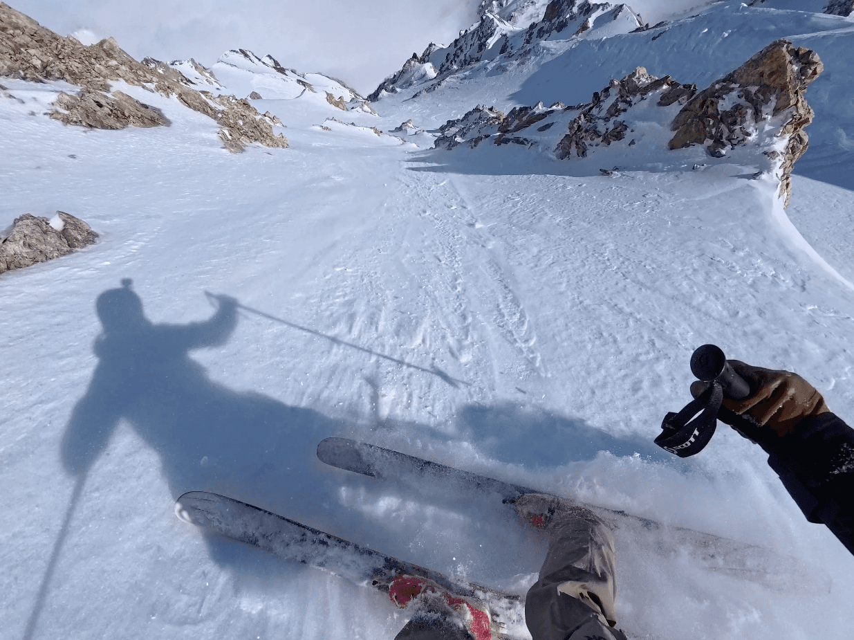
Lower down and into the now cloudy runout, powder - windgrain - debris variable ensued, keeping us on our toes. The 2012 Dynafit Neo U’s that I had found on consignment for $40 (and boasted to everybody about - how could I not?) no longer had the rigidity (or maybe never did) required to negotiate the >4000 feet of variable, sustained pitch. Combined with getting jelly-legged by 10000 feet of gain and sleep deprivation, I was not in a desirable margin of safety and feeling the PUCKER.
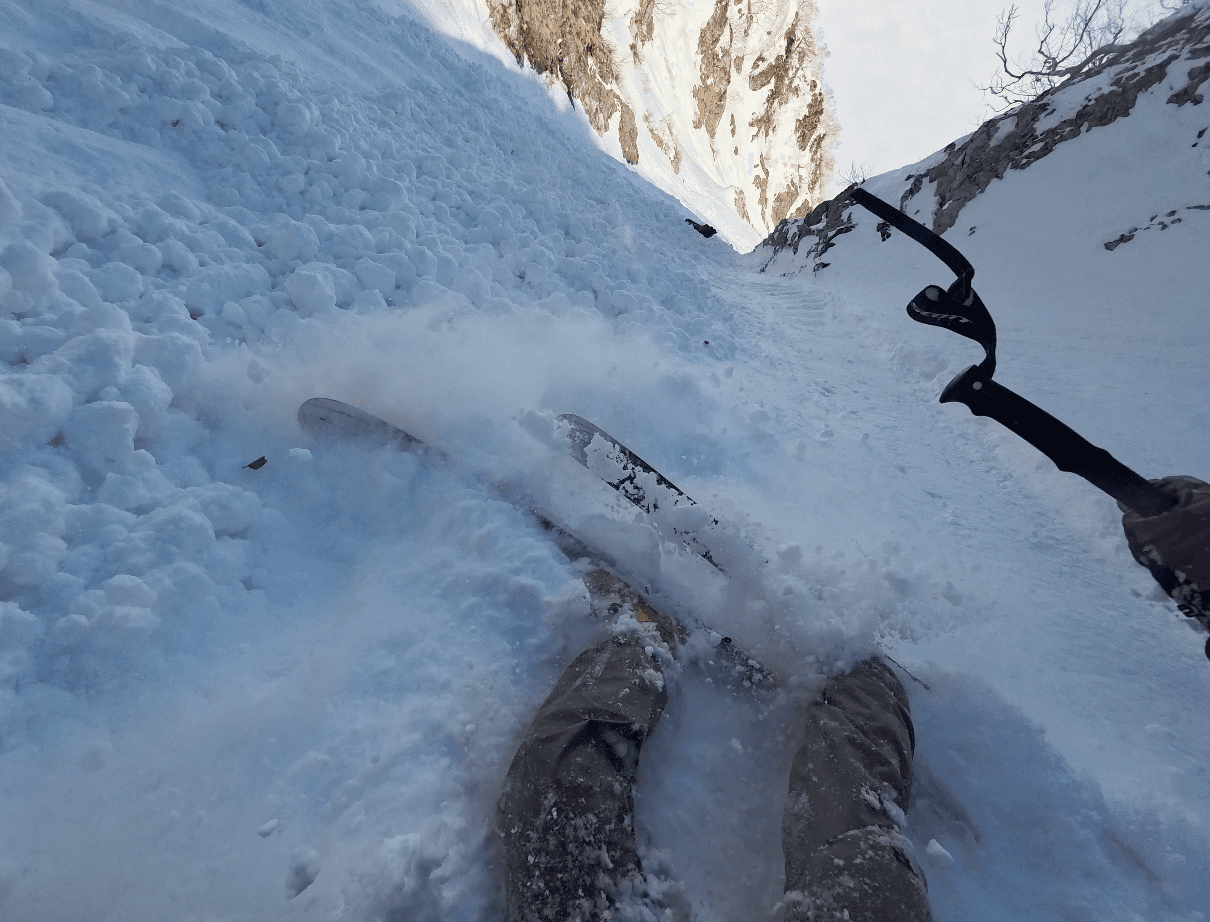
Rick and I getting our asses sat down by the melt-freeze wet loose debris (above).
We gathered just below the chute and skied line-of-sight the way out like a guided operation.
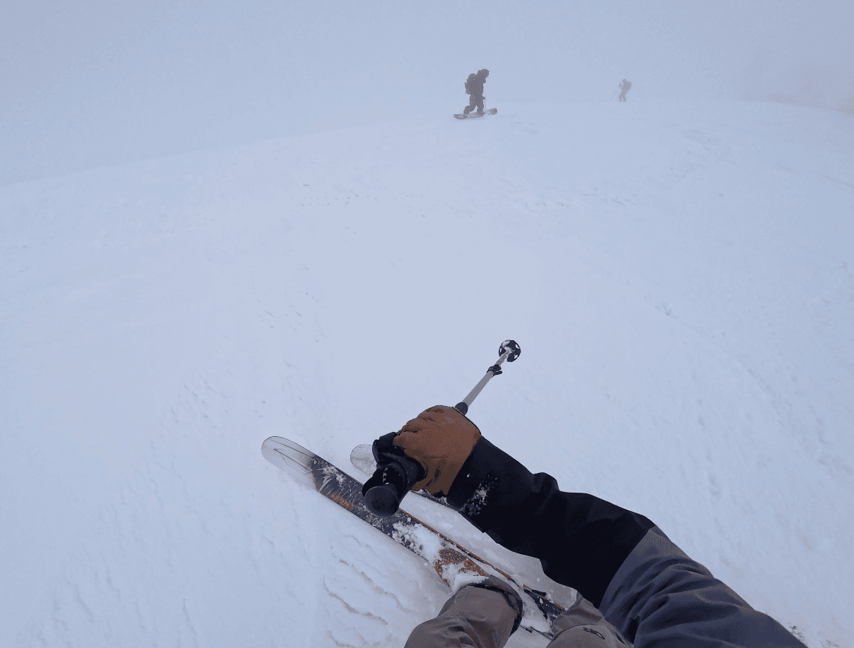
Topo map in Josh’s hand and one last surge of adrenaline carried us back up the Obinata col through the white-out. A wave of relief, minus the latent anxiety of being in low-vis backcountry, washed over us.
We got back to the car just before 5pm and headed straight to KOKEMOMO per Rick’s recommendation. Fun day.
Reflection
Radios helped us coordinate the descent, but our aggregate of just 3 hours of sleep led to a collective hallucination that nearly led to us sluffing each other out in the choke. Perhaps a story for another time. Sleep matters.
We got gapped by a father-son duo clad in matching full North Face kits. The dad was carrying the little kid’s (~10 y.o.?) skis as well as his own. Very cute. Also humbling.
Bring a stove (e.g. whisperlite) so we could melt snow for drinking water. Bring scraper/wax for glop, emergency bivy, and better first-aid kit.
Start earlier so that we could have dropped in earlier, or go faster
I should have brought my sun hoodie. Solar aspect were warm and sapped us harder than expected
Ran through a team nutrition check. I started rationing hard near the end. Turns out, Rick had food left!
Outmap is sick.
The Dynafit Neo U’s are a bit soft for skiing steep variable. Any way I can booster strap my Dynafit Neo U’s?
My legs were jello by the time I was dropping in. My downhill ski performance was not optimal.
I had gone a full season without a wax, let alone a tune. Bad bad bad.
